
Wash Post — Norfolk moves ahead on sea wall project to protect against storms
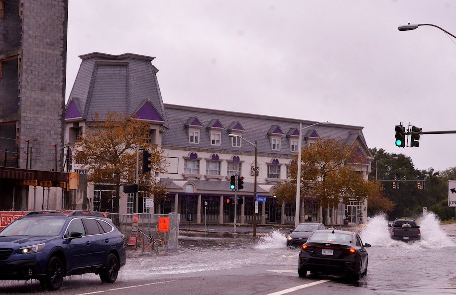
Tidal flooding fills the intersection of Olney Road and Boush Street in Norfolk on Monday. It floods there so often that locals refer to it as Lake Olney. (Jim Morrison for The Washington Post)
Oct 5, 2022
By Jim Morrison — Without the $1.8 billion initiative, the Army Corps of Engineers says much of the city would be at risk for flooding by 2075. But questions persist about its effectiveness and impact.
Norfolk’s downtown waterfront is a parade of people drawn to the water during a Friday lunch hour, some heading to a waiting cruise ship and others strolling to Town Point Park with its expansive view of the Elizabeth River, the shipyards and the city of Portsmouth across the water.
They stream through a portal in a concrete flood wall running along Waterside Drive that blends into the streetscape, a guardian that for 50 years has protected the city’s economic heart. But the combination of rising waters and stronger storms, along with sinking land, means the wall now falls short of providing the protection that the federal government demands.
To arm the city against those storms, Norfolk has entered the first phase of a $1.8 billion project being designed with the Army Corps of Engineers that features an existing 2,700-foot-long downtown wall raised by about five feet and extended to cover the minor league baseball stadium on the Elizabeth River. Over time, more barriers and other protections, including nearly eight miles of sea walls, levees and berms, will be extended along the city’s southern and western flanks on the Elizabeth and Lafayette rivers.
…