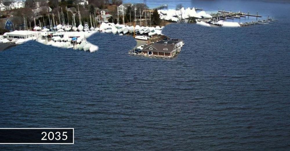
WPRI — Parts of Barrington will be underwater by 2035, sea-level data shows
Jan 10, 2022
By Tolly Taylor
BARRINGTON — In just over a dozen years, Barrington will contend with several key roads flooding every month, including the town’s evacuation route for hurricanes, according to experts and sea-level data projections.
These projections show a roughly three-mile stretch of Route 114, the town’s evacuation route, will be submerged twice a day by 2050. Teresa Crean, a coastal research associate at the University of Rhode Island Coastal Institute, told Target 12 that Barrington is one of the leaders in climate change mitigation across the state.
In 2019, the town was one of the first to partner with the R.I. Infrastructure Bank to create a Municipal Resilience Program, which uses grant funding to help communities with projects like road elevation and coastal erosion control. Barrington received a $201,000 grant that same year to restore Walker Farm off of Route 114 to a salt marsh, which experts say will slow the impacts of rising sea levels along the road.
“But at what point do we have to say, this is no longer feasible, and this roadway will be under water twice a day?” Crean said. “We need to really rethink, and it could end up costing big dollars.”
A central artery in the East Bay, Route 114 carries 25,000 vehicles every day, according to the R.I. Department of Transportation.
“We have to consider the road network — if you elevate your property, but your road’s still wet, is it really solving the problem?” Crean said. (Crean has since been hired as Barrington’s town planner.)
And the risks in Barrington aren’t some distant worry.
Rhode Island’s STORMTOOLS website shows that, because of sea-level rise that’s already occurred over the past two decades, if a storm like 1954’s Hurricane Carol hit Barrington today, it would effectively make it a series of islands. As the image below shows, nearly half of Barrington’s land would be underwater in such a storm.
…

